
Walking a Ridgewood Street Directory
A street search works best as an address chain, not as a household roster. Normalize the street number and name first. The New Jersey assessment system can then connect that location to a tax-listed owner and parcel keys. Those keys lead to a map and, when needed, a recorded deed. The voter route has a much narrower role: the state lookup is meant to confirm one person, not browse a whole street. Historical numerical directories add a dated address association, but they should not be mistaken for a current record.
- Search the location in the assessment system and save the situs, block, lot, qualifier, owner name, mailing address, output mode, and search date.
- Use the parcel map to check the street geometry and tax-map identifier. Do not rely on a map popup for an owner value that has not been verified.
- Search the current owner in the land-record index, then use the purchase deed to identify the prior grantor and legal parcel description.
- Use the individual voter lookup only to confirm a particular person where the law permits. A full registry request follows a separate county or state process.
- For an earlier address association, compare the numerical sections of Ridgewood's historical directories with maps and the parcel description.
Keep the source year beside every name. That simple habit prevents a current owner, a former deed party, and a historical directory entry from being blended into one conclusion.
Ridgewood Assessment Fields by Street
NJ Assessment Records Search is the practical first stop for a Ridgewood address search. Choose the Current Owners/Assmt List or Deed/SR1A List, then select BERGEN and Ridgewood district 0251. Location searches can browse an address or street, while owner, block, lot, and qualifier provide different ways to narrow a result. The portal presents data as-is and cautions that assessment is not market value and that late SR1A sales may be incomplete.
| Assessment control | Type | Required | Ridgewood use |
|---|---|---|---|
| Database | Dropdown | No marker | Current Owners/Assmt List or Deed/SR1A List. |
| County / District | Dropdown | No marker | BERGEN and Ridgewood 0251, with ALL 0200 also shown. |
| Search Format | Choice | No | Simple or Advanced. |
| Output Format | Choice | No | Single Line, Multi Line, or Excel. |
| Location / Owner Name | Text | Optional | Location supports street variants; owner is tax-listed, not an occupant field. |
| Block / Lot / Qualifer | Text | Optional | Legal parcel keys. The portal spells the final label “Qualifer.” |
| Items per page | Dropdown | No | 10, 20, 50, 100, 500, or 1,000 rows. |
For a long street, use Multi Line or Excel output and test directional, suffix, and qualifier variants. Preserve the actual query, because a corner parcel, a condominium qualifier, a private road, or a historic subdivision name can change what a location search returns.
The NJ Assessment Records Search interface shows the district and search controls used for address-led parcel work.
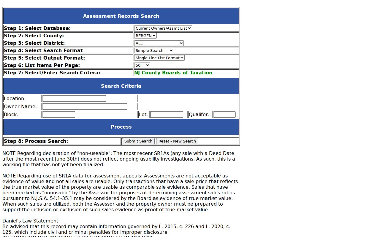
The screenshot is a reminder to record both the selected database and the output style, since a list result is an index to verify rather than a complete resident list.
Ridgewood Parcel Map Cross-Checks
The Ridgewood ArcGIS Map Viewer is intended for parcel browsing, and Bergen's parcel feature layer provides the underlying geometry route. The service identifies its display field as STNAME and includes a TAXMAP field. Its verified legend includes TAX MAPS, PARCELS, MUNICIPALITY, and BERGEN COUNTY. Exact popup details, zoning layers, flood layers, and live neighbor-click behavior were not confirmed in the research.
Zoom to the street, identify the parcel shape, note its tax-map or block-and-lot bridge, and cross-check that key against the assessment search and deed index. Geometry can resolve a corner or a parcel with more than one row. It cannot, by itself, establish ownership or residence. The service's maximum record count of 2,000 is a technical setting, not a count of Ridgewood parcels.
Note: Map and assessment results are strongest when saved with the same access date and reconciled against the tax-map identifier.
Ridgewood Street Directory Record Coverage
Several Ridgewood records are keyed to an address, but each answers a different question. The assessment list supplies a current tax association. A deed documents a recorded transfer. A map describes parcel geography. A historical directory gives a dated address association. Keeping their roles separate makes the address trail useful without overstating its coverage.
| Address record | Custodian | What it can establish | Access route |
|---|---|---|---|
| Assessment list | NJ/Bergen system and Ridgewood Assessor | Tax-listed owner, location, parcel, possible mailing details, value, and deductions | Free list search; property card through OPRA |
| GIS parcel layer | Bergen/Ridgewood | Geometry, street and tax-map identifiers, and verified map layers | Public map or service |
| Recorded deed | Bergen County Clerk | Grantor, grantee, transfer date, legal description, and book/page or document path | Online from 1970; older counter or microfilm |
| Tax map or plat | Village and County | Blocks, lots, roads, acreage, and right-of-way context | PDF or counter |
| Voter record | State and county election offices | Statutory registration fields when lawfully obtained | Individual lookup or Title 19 request |
| Historical directory | Ridgewood Public Library Heritage Center | Dated address, household, business, or cross-reference information | Library shelf or microfilm |
| Permit or code file | Village custodian | Construction, inspection, or code evidence if releasable | Defined OPRA request; no verified public index |
The Ridgewood Assessor identifies, lists, and values local real property. When a property-record card is needed, the research directs requesters to the Village's OPRA route rather than suggesting that every card appears in the assessment portal.
Ridgewood Parcel-to-Deed Trail
After identifying a parcel, move from the current tax-listed owner to the purchase deed in the Bergen County Land Records search. Read the seller, or grantor, and search that person as a prior grantee to move backward through title. Constrain every step with Ridgewood, the block or lot, dates, and the legal description. A plat can help when the deed uses a subdivision or lot reference instead of a familiar street address.
Record the instrument type, execution and recording dates when separately shown, grantor, grantee, municipality, block, lot, consideration, book/page or document number, and image or certified-copy status. Search estate names, executors, trustees, and corporate parties as written. Those role labels matter in a grantor-grantee index. They should not be silently converted into a claim about who occupied the property.
Bergen County Land Records is the recorded-title route for a Ridgewood street directory search after the parcel keys are known.
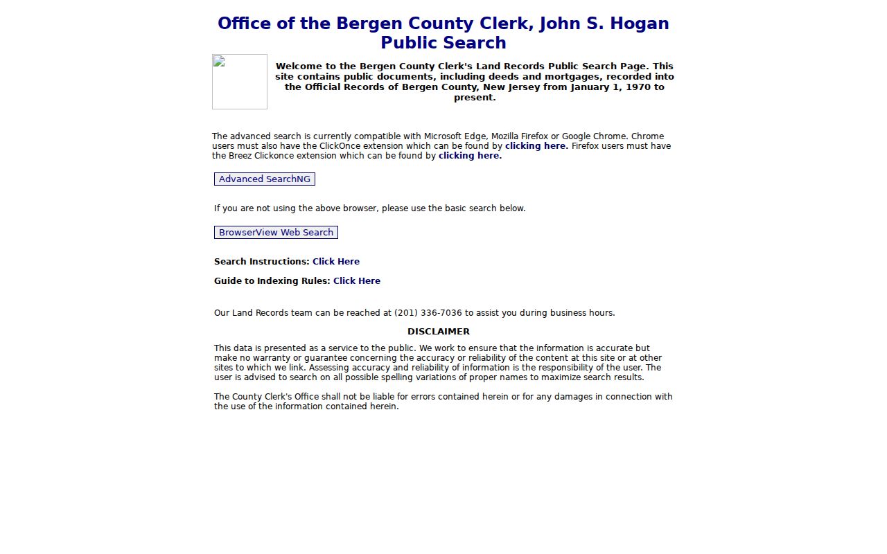
The index supports a reproducible title trail when its party roles, parcel references, and date limits are captured with each result.
Note: A deed records a title event, so confirm its legal parcel and dates before treating it as an address history.
Ridgewood Deeds Before 1970
The online Bergen land-record index begins January 1, 1970. That is an online-search boundary, not the beginning of Ridgewood property history. Earlier work shifts to County Clerk books, counter research, and microfilm. The New Jersey Archives notes Bergen deeds before 1785, while the Ridgewood house-history guidance treats early deed material as a promising lead that must be checked for the particular book and access path.
The safe fallback chain is specific: confirm the modern parcel, consult the County Clerk or its records division for older books or microfilm, then use the State Archives and library guidance where needed. An older deed may be indexed by party or legal description rather than street name. For that reason, carry block, lot, subdivision, book/page, and date details across the change in medium.
Ridgewood Street Directory History
Historical address work is most useful for family history and house research. The Ridgewood Public Library Heritage Center holds the Millar 1897 material, Breed directories from 1898 and 1904 through 1915, and Price & Lee volumes from 1926 through 1973. The Price & Lee numerical sections offer the strongest address-led route. Copy the street spelling, number, and any printed cross-reference before comparing it with a map or a later record.
A Ridgewood Directory Book search is the fuller route for reading those collections and their abbreviations. Here, the relevant point is narrower: an old numerical or reverse listing can show a dated address association, not a continuously current household. Pair it with a deed, census, obituary, or map when the relationship matters.
- Parcel
- A defined piece of land in a tax or map system, often linked through a block and lot.
- Situs address
- The physical location of the parcel, which can differ from the mailing address used for notices.
- Plat
- A recorded map that lays out lots, streets, or a subdivision and can bridge a deed description to a place.
- Criss-cross directory
- A directory section organized by address or street instead of only by surname.
Ridgewood Maps Bridge Addresses
When an older number does not line up with a current street label, use maps before forcing a match. The Ridgewood tax-map exhibit shows blocks, lots, street names, parcel lines, right-of-way marks, exempt parcels, acreage, and a stated scale. Its revision entries run from 1959 to 1990. The Heritage Center also holds the 1897 Millar map, assessment maps from 1908, 1913, 1925, and 1969, and the 1913 Bromley map.
The 1916 Library of Congress Sanborn set has 31 sheets and includes Ridgewood with nearby communities. Later Sanborn editions for 1925, 1928, and 1930 can help locate an earlier number and building footprint. No official source verified a complete Ridgewood street-renumbering or renaming schedule. Preserve both address forms and use maps, lot lines, and legal descriptions rather than inventing a conversion.
Note: A predecessor label such as Ridgewood Township or Godwinville may describe historical geography, not a mistake in the record.
Ridgewood Voter Records by Address
New Jersey's voter system is not a public street-by-street household directory. The state registration lookup is for individual confirmation, and its live field order was not verified during the research. N.J.S.A. 19:31-18 lists public registry fields including name, address, date of birth, party affiliation, and voting history, subject to protected-address exclusions and limits on use.
A voter may request a certified printed registry list for an election district at the statutory rate, and an electronic county list is available under the statutory process and reproduction-cost cap. Ask the county elections custodian about scope, fields, delivery medium, fees, currency, and protected-address exclusions. Ballot choices are never public, and a registration result is not evidence of every person at an address.
Ridgewood Address Records Through OPRA
No verified public Ridgewood portal was located for permit or code files by address. When that evidence is needed, submit a narrow written request through the Village OPRA process. State the defined address, the date range, and the categories sought, such as permits, certificates, inspections, or code cases. Ask whether responsive material is paper, archived, or electronic.
The Village Clerk is the practical local intake route for these records. Under the New Jersey Open Public Records Act, a custodian generally provides a grant, denial, or availability notice within seven business days when a record is available. The request must still go to the right custodian, and no result should be read as proof that no event or resident existed.
Note: Ask the custodian to identify the record medium and any archive location when a defined address search returns no responsive file.
Ridgewood Street Directory Limits
A street directory cannot show every person who lives at an address. Assessment data identifies a tax-listed owner and parcel. A deed records a title event. A directory is dated. Voter data has statutory limits and protected-address exclusions. DMV and utility customer addresses are not ordinary public address directories. A missing name can reflect timing, privacy protection, an incomplete query, or a record type that never captured the relationship.
Lawful personal use. Ridgewood address records can support family history, property curiosity, estate research, and civic understanding. Do not use them to stalk, harass, intimidate, or harm anyone, and do not try to reverse-engineer protected addresses.
When the goal becomes confirming one particular person rather than tracing a street, use a Ridgewood resident lookup approach that compares independent records and respects the limits of each source.